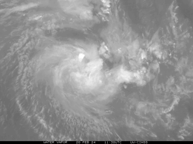
Fourth cyclone bulletin for Mauritius issued at 0410 hours on Wednesday 21 February 2024.
Moderate Tropical Storm Eleanor is evolving in a favourable environment with central pressure 990 hPa and gusts near the centre of the order of 110 km/h. At 0400 hours, Eleanor was centred at about 630 km almost to the north-northeast of Mauritius near latitude 15.0 degrees South and longitude 60.5 degrees East. It is moving in a general southeasterly direction at about 10 km/h.
The numerical weather models maintain that Eleanor will recurve towards the south and will eventually assume a south-south-west trajectory at an accelerated speed while continuing to intensify further. On this new track, Eleanor will approach our region and will represent a potential threat to Mauritius.
A cyclone warning class II is in force in Mauritius.
The public in Mauritius is advised to take preliminary precautions.
Weather will be partly cloudy during the day. Clouds associated with the moderate tropical storm will start to cross the Island as from late afternoon with passing showers mainly to the East, the South and over the high grounds. As Eleanor approaches our region, the weather is expected to deteriorate tonight with moderate to heavy thundery showers.
Wind will blow from the east-southeast at a speed of about 25 km/h with gusts reaching 60 km/h, strengthening gradually as from this afternoon.
Sea will gradually become very rough with swells beyond the reefs. The public is advised not to venture at sea.
A cyclone warning class II is in force in Mauritius.
The next bulletin will be issued at around 1010 hours.
Source : metservice.intnet.mu
